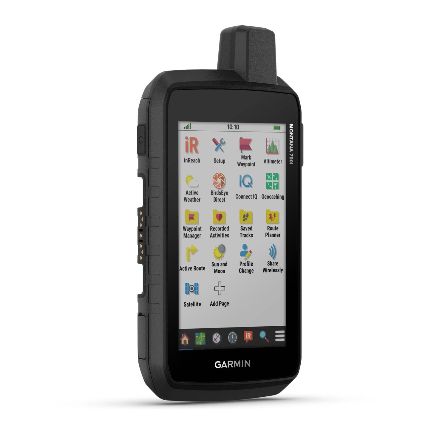
Garmin Montana 700i
Garmin Montana 700i
Regular price
$1,449.00 NZD
Regular price
Sale price
$1,449.00 NZD
Unit price
per
Tax included.
Couldn't load pickup availability
To keep adventurers in touch and on track, the Montana 700i handheld combines the flexibility of on- or off-road navigation with global messaging and interactive SOS via inReach satellite technology
Features
- A full QWERTY keyboard lets you easily type messages.
- Wander wider and still stay in touch — with inReach for messaging and 24/7 SOS
- Routable TopoActive Australia and New Zealand maps.
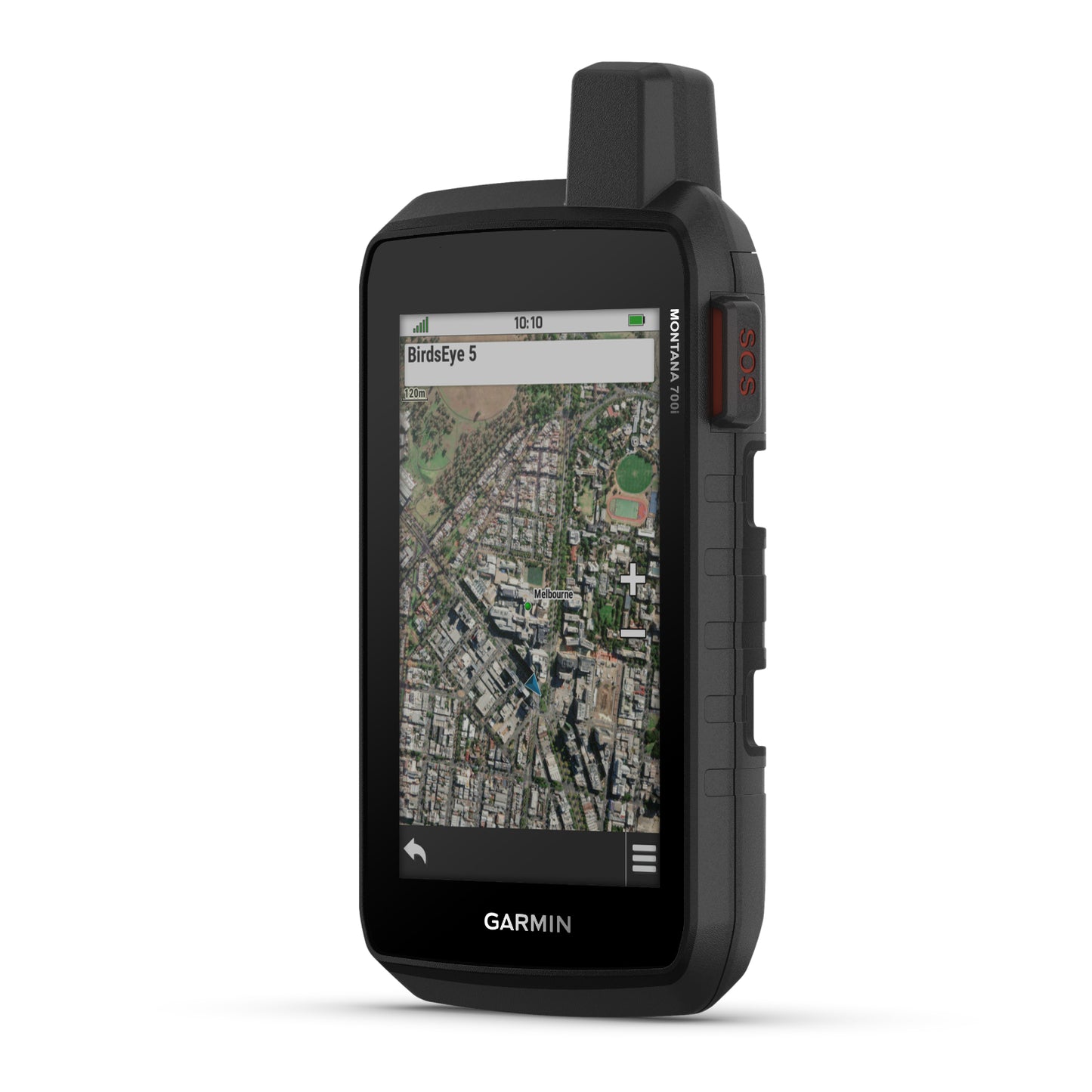
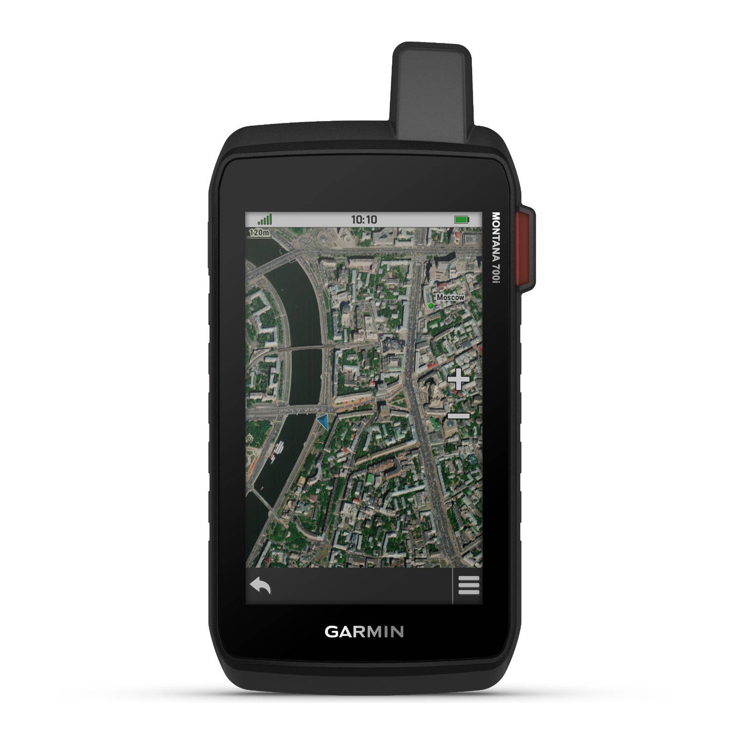
- Get the clear perspective of BirdsEye Satellite Imagery right to your device.
- Power your adventures with 18+ hours of lithium-ion battery life in GPS mode.
Specs
- HIGH-SENSITIVITY RECEIVER: Yes
- PHYSICAL DIMENSIONS: 9.19 x 18.30 x 3.27 cm
- TOUCHSCREEN: Yes
- DISPLAY SIZE: 6.48 x 10.80 cm; 5" diag (12.70 cm)
- DISPLAY RESOLUTION: 480 x 800 pixels
- DISPLAY TYPE: WVGA transflective, dual orientation
- WEIGHT: 410 g with included lithium-ion battery pack
- BATTERY TYPE: Rechargeable lithium-ion (included)
- BATTERY LIFE: GPS Mode: up to 18 hours, Expedition Mode: up to 330 hours, GPS Mode: 10 min Tracking: up to 18 hours, Expedition Mode, 30 min Tracking: up to 300 hours
- WATER RATING: IPX7
- MIL-STD-810: Yes (thermal, shock, water, vibe)
- INTERFACE: High speed micro USB and NMEA 0183 compatible
- MEMORY/HISTORY: 16 GB (user space varies based on included mapping)
- PRELOADED MAPS: Yes (TopoActive Australia and New Zealand)
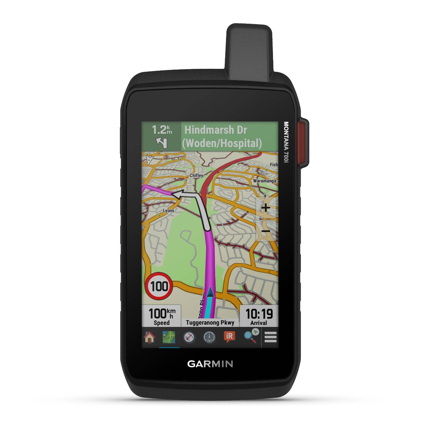
- AUTOMATIC ROUTING (TURN BY TURN ROUTING ON ROADS) FOR OUTDOOR ACTIVITIES: Yes
- AUTOMATIC ROUTING (TURN BY TURN ROUTING ON ROADS) FOR MOTORIZED VEHICLES: Yes
- BIRDSEYE: Yes (direct to device)
- INCLUDES DETAILED HYDROGRAPHIC FEATURES (COASTLINES, LAKE/RIVER SHORELINES, WETLANDS AND PERENNIAL AND SEASONAL STREAMS): Yes
- INCLUDES SEARCHABLE POINTS OF INTERESTS (PARKS, CAMPGROUNDS, SCENIC LOOKOUTS AND PICNIC SITES): Yes
- DISPLAYS NATIONAL, STATE AND LOCAL PARKS, FORESTS, AND WILDERNESS AREAS: Yes
- EXTERNAL MEMORY STORAGE: Yes (32 GB max microSD™ card)
- TRACK LOG: 20000 points, 250 saved gpx tracks, 300 saved fit activities
- GPS: Yes
- COMPASS: Yes (tilt-compensated 3-axis)
- CONNECT IQ™ (DOWNLOADABLE WATCH FACES, DATA FIELDS, WIDGETS AND APPS): Yes
- SMART NOTIFICATIONS ON HANDHELD: Yes
- ACTIVE WEATHER: Yes
- LIVETRACK: Yes
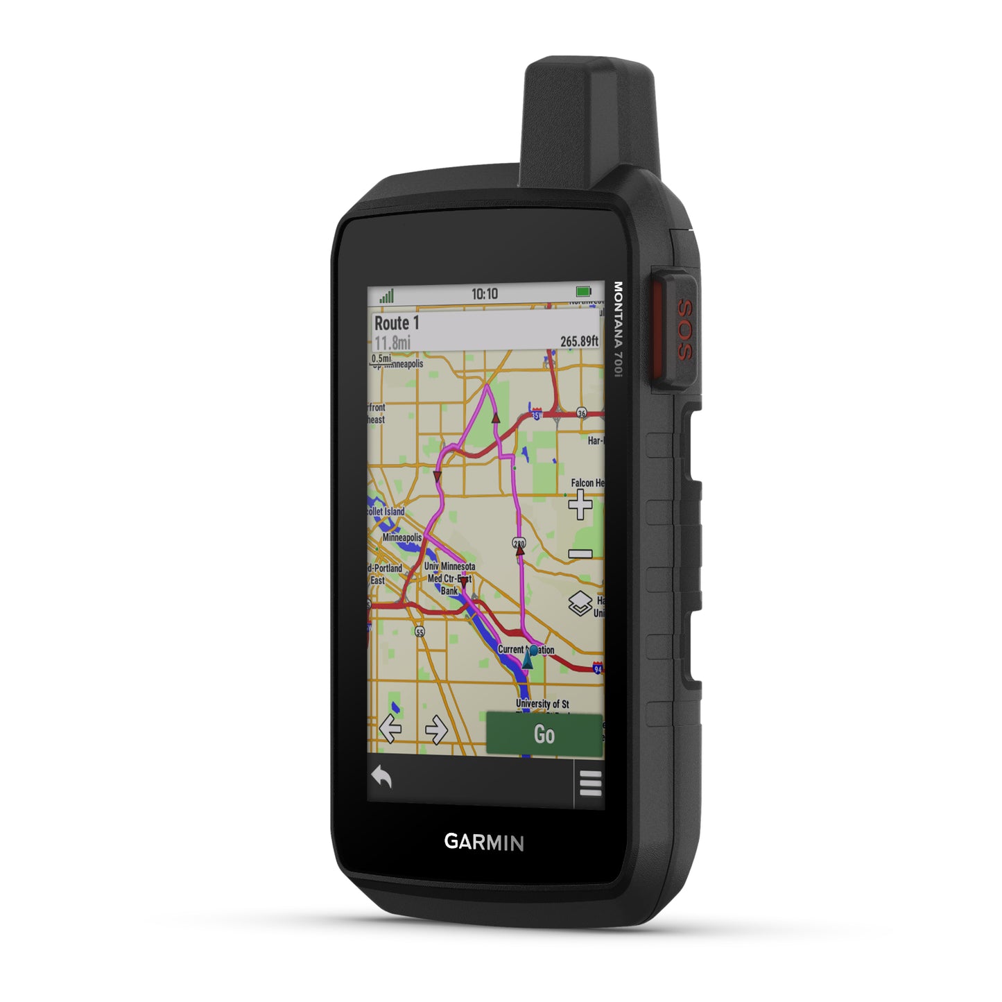
- POINT-TO-POINT NAVIGATION: Yes
- INTERACTIVE SOS: Yes
- SEND AND RECEIVE TEXT MESSAGES TO SMS AND EMAIL: Yes
- VIRTUAL KEYBOARD FOR CUSTOM MESSAGING: Yes
- EXCHANGE LOCATIONS WITH OTHER INREACH DEVICE: Yes
- MAPSHARE COMPATIBLE WITH TRACKING: Yes
- SEND WAYPOINTS TO MAPSHARE DURING TRIP: Yes
- WIRELESS CONNECTIVITY: Yes (Wi-Fi®, Bluetooth®, ANT+®)
Note: TWO-WAY GLOBAL MESSAGING, INTERACTIVE SOS ALERTS, GLOBAL CONNECTIVITY requred subscription; for more information visit:
ht tps://discover.garmin.com/en-NZ/inreach/personal/#subscriptions